Projects & Groups
Here are a few featured projects and groups. (You'll find all our Projects and Groups in our Zotero library. Visit our Contribute page to learn how to add your project and group.)
Hypercities
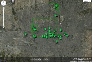
HyperCities is a collaborative research and educational platform for traveling back in time to explore the historical layers of city spaces in an interactive, hypermedia environment.
David Rumsey Map Collection

The David Rumsey Map Collection “has over 26,000 maps and images online. The collection focuses on rare 18th and 19th century North American and South American maps and other cartographic materials. Historic maps of the World, Europe, Asia, and Africa are also represented.”
Visit the David Rumsey Map CollectionWorldMap

AfricaMap was developed by the Center for Geographic Analysis to make spatial data on Africa easier for researchers to discover and explore. It is an instance of WorldMap which is built on a lightly customized Open Source software stack that includes OpenLayers, ExtJS, TileCache, MapServer, GeoServer, and PostGIS.
AfricaMap requires one of these XML savvy browsers: Firefox 2+, Internet Explorer 7+, and Google Chrome 2+.
Visit World MapNYPL Map Rectifier

The NYPL Map Rectifier is a crowdsourcing tool for digitally aligning (or “rectifying”) historical maps from the NYPL’s collections to match today’s precise maps. Visitors can browse already rectified maps or assist the NYPL by aligning a map.
Visit the NYPL Map Rectifier (beta).Spatial History Project

The Spatial History Lab at Stanford University is a place for a collaborative community of scholars to engage in creative visual analysis to further research in the field of history. Recent projects include: Shaping the West, Terrain of History, Holocaust Geographies, and Chile's Aquaculture Industry, 1950-2000.
Visit the Spatial History ProjectNewberry Library Map & Cartography Collection

“The Newberry Library holds an estimated 500,000 maps issued separately and in atlases and books. Half of these were published before 1900. The map and atlas collections are supported by very extensive holdings in the literature of the history of cartography, cartobibliography and map catalogs, and gazetteer and place name literature. To date, over 70,000 cartographic titles (maps, atlases, and secondary literature) are described in the Newberry Library Cartographic Catalog (NLCC).”
Visit the Newberry Library Map & Cartography CollectionNGDA

The National Geospatial Digital Archive, “a collecting network for the archiving of geospatial images and data,” is an offshoot of the Library of Congress’ National Digital Information Infrastructure and Preservation Program. The NGDA project’s objectives include creation of a national network “committed to archiving geospatial imagery and data,” development of preservation best practices for archived geospatial data, and collecting and archiving at-risk geospatial data and images.
Visit the National Geospatial Digital ArchiveKeck DCMP

The Keck Digital Cultural Mapping Program, an undergraduate curriculum at UCLA, brings “the analytic tools of Geographic Information Systems (GIS) and other map-based digital applications together with traditional methods of humanistic inquiry.”
Visit the Keck Digital Cultural Mapping ProgramAAG - Historical GIS Clearinghouse & Forum

“The Historical GIS Clearinghouse and Forum provides a central reference point for scholars seeking to access or catalogue projects that apply geographic technologies to historical research. Visitors are encouraged to explore–and contribute to–the resources on these pages.”
Visit the Association of American Geographers Historical Clearinghouse and Forum